The Details
This Missing Link was written in response to a planning application (2023) to rebuild Dumfries High School and the associated David Keswick Sports Centre. While we have no objection to replacing the school and sports centre, we submitted a planning representation due to the need to improve cycling access to the school, and lack of adequate cycle parking.
The case officer’s report notes that the level of cycle parking is lower than the standards given in the national guidance because the number of students cycling to Dumfries High School is so low (currently 1.6% of all pupils). They concluded that cycle parking to accommodate 10% of pupils will be sufficient as it is unlikely that the number of children cycling to school will increase to the levels where the amount of bike parking given in the guidance would be needed (41%).
While true, it also reflects a lack of ambition when it comes to sustainable travel.
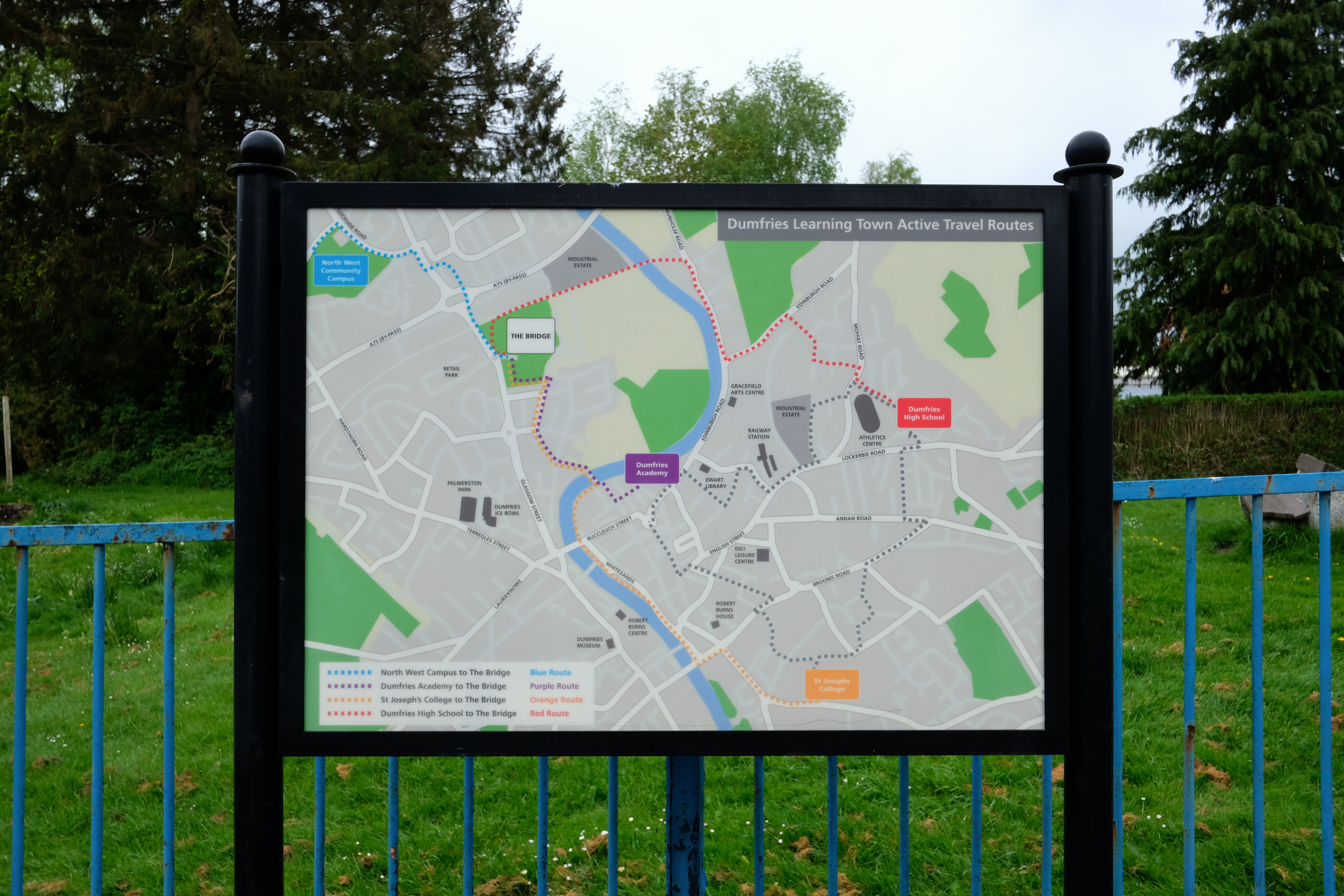
So why is cycling so low among school kids in Dumfries? There are cultural reasons of course, but just across the North Sea, Dutch towns and cities have been built in such a way that cycling pretty much everywhere, including to school, is safe not just for secondary-school age kids, but those in primary school as well. By contrast, although Dumfries High School is now linked by a cycle path from the Summerpark estate and from there to the Caledonian Cycleway, cycling to school from other directions is still pretty challenging, and not what you’d want your 11-year-old having to tackle on their way to school.
In our planning representation we noted that the route to the school from Marchmount is incomplete (as is also noted in the Travel Plan that forms part of the planning application) and that the route from Summerpark is unsigned, and lacks a dropped kerb for access by bikes.
Neither issue is dealt with in the planning report. Although it notes that development proposals should “prioritise personal travel by mode in the following order: walking, cycling, public transport and lastly car” and “provide opportunities for a modal shift from private car use”, we’re told that the council’s roads officer is satisfied with the arrangements in the plan, apart from some requirements around traffic calming, off-street parking and electric car charging. Nothing is included about improving access for cycling either in the immediate area of the school or from any of the surrounding areas where its pupils live. In other words, we’ve decided to accept the status quo: concentrating on taming and managing traffic as best we can, instead of working to reduce it. This is disappointing, for a council that has not just declared a climate emergency – but has also been designated as part of an international bike region by the UCI.
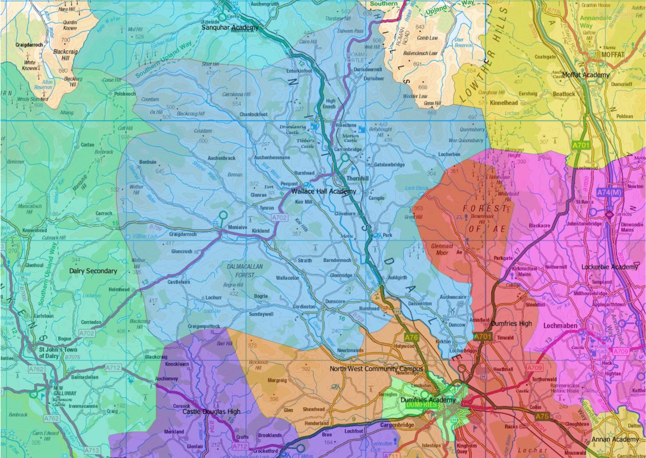
So what do we suggest? In the long run, we believe that we’ll only see substantial numbers of pupils cycling to school by ensuring they can do so safely, and that means tackling the missing links in the network connecting the school to its catchment areas and The Bridge. The map below shows the High School catchment area. Viewing this as the likely source of most potential school journeys, it’s clear that access from the west and the north is very close to being good, while access from the south and east is much more difficult.
Coming from the West: The Bridge
There is a signposted walking route of 1.6 miles between the Bridge and the High School, by way of the Maxwelltown Path and Carnegie Street, crossing the Moffat Road using a pedestrian crossing and coming into the existing school via Marchmount Avenue. But this route is incomplete for cycling – the crossing of the Moffat Road is for pedestrians only, not bikes and there is no cycling provision along Marchmount Avenue, which will be busy and hence dangerous during school run times. Otherwise, this distance would be very easy and quick to cycle and completing this route would be very easy to achieved.
From Summerpark, Heathhall and Locharbriggs
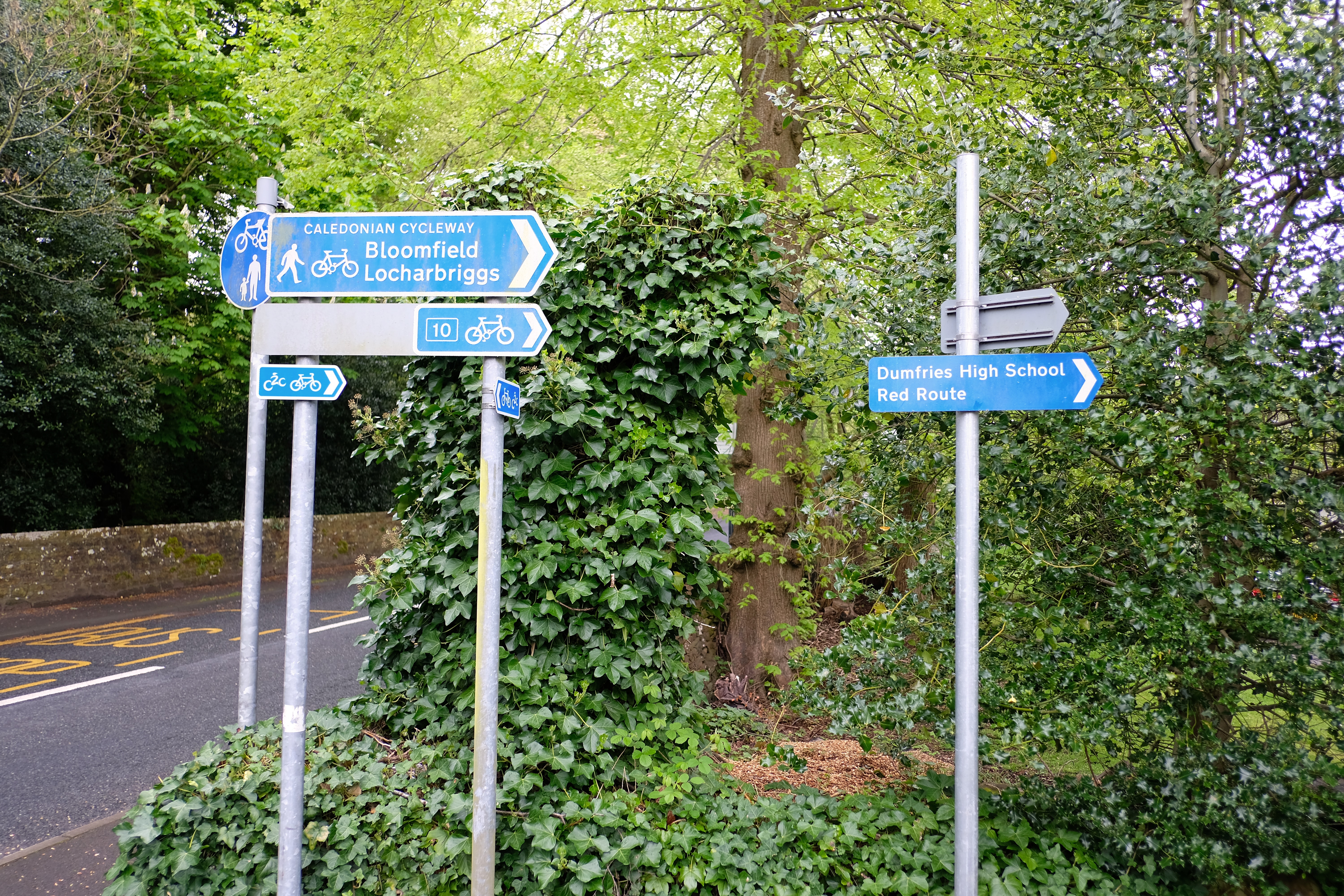
As noted, there is now a path that connects the back of the High School to Summerpark, which in turn provides good cycling conditions and connects well to the Caledonian Cycleway which serves Heathhall and Locharbriggs. These journeys are less than 3 miles and largely flat – easily accessible for a secondary school student. There is a shared-use path along the length of Summerpark Road which provides a safe route from the Caledonian Cycleway to the path to the High School, but there is no wayfinding either at the start of the path, nor on the Caledonian Cycleway. Having this route clearly marked would save cyclists from having to use the Moffat Road, which has no cycling provision at all and is a busy and hostile road to cycle on.
From Noblehill, Georgetown, Calside and Larchfield
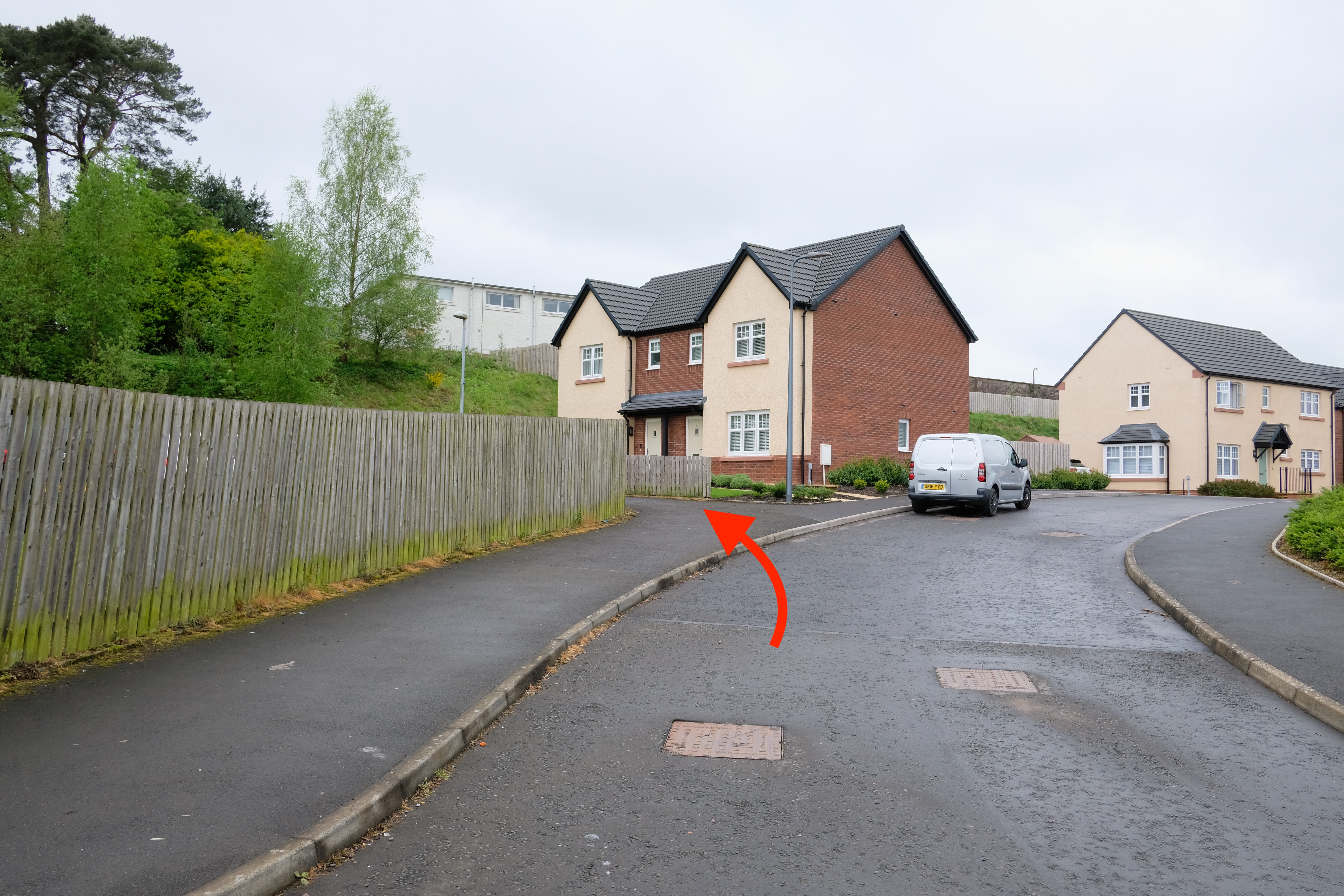
Students living closest to the school are likely to want to walk to school rather than cycle, but for those coming from Georgetown, Calside and Larchfield, a distance of 1-2 miles, cycling would save time. However, none of the routes from those areas are very inviting, especially for children cycling independently. As we've detailed in the Georgetown, Calside and Larchfield missing link the main problem is that the railway line acts as a barrier, with only three possible crossing points.
When approaching via Eastfield Road and Brooms Road, there is no cycle path along the top end of Brooms Road. Once under the railway line, there would potentially be room to put one in. There would need to be a suitable crossing of the Annan Road to get cyclists onto Kirkcowens Street to bypass the roundabout there, and then wayfinding measures through the residential streets up to the Lockerbie Road. There is already a pedestrian crossing of the Lockerbie Road which connects to a path through to Bane Loaning and the school entrance, which could be converted into a toucan (bike and pedestrian) crossing to complete the route.
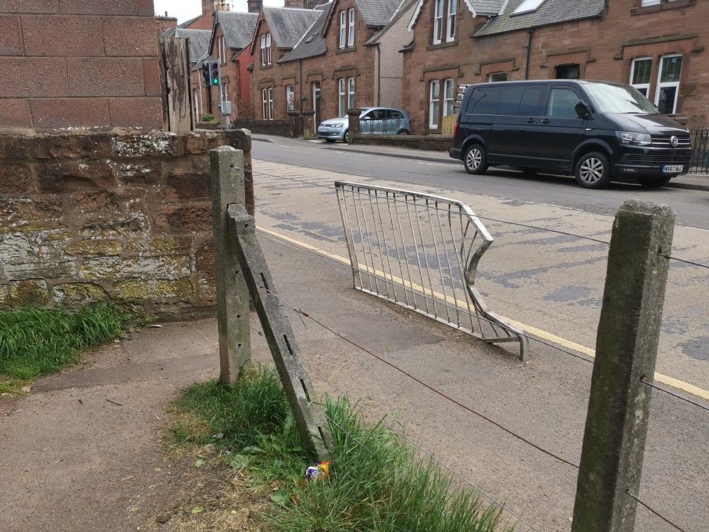
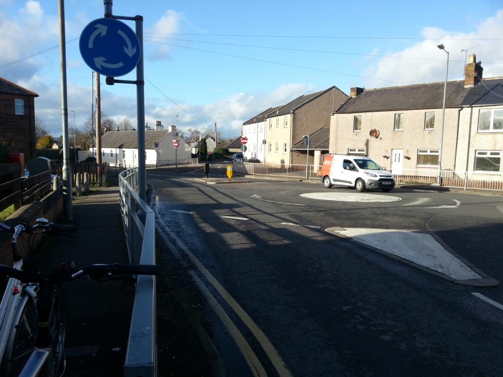
Approaching via Georgetown Road, the junction with the Annan Road is very hostile to pedestrians and cyclists, with a busy roundabout surrounded by railings narrowing the pavements on all sides. Removing some of the railings to allow cycle access down Millburn Avenue. Creating a crossing opposite the cafe and shop would provide a route via the park up to Greenbrae Loaning which is slightly less busy as it is filtered by a one-way section at one end. However, Georgetown Road itself is also both narrow and busy, with the bridge over the railway line forming a bottleneck, and hence a barrier to cycling for most people (see Georgetown, Calside and Larchfield for more details of how this could be tackled).
The third crossing point, at Loganbarns Road, is a little quieter than Georgetown Road but involves a substantial detour. Thinking big, a pedestrian and cycle-only bridge over the railway line would serve to open up Georgetown more widely to active travel.
From Collin
It is not much further from Collin to the High School than it is from Locharbriggs – at least as the car drives: 3.3 miles, a very achievable ride for a teenager to tackle. As covered in our Collin missing link there is no safe, direct cycle route from Collin to Dumfries. The closest thing to a safe route (via Roucan Loch, and the Heathhall Industrial estate to the Caledonian Cycleway) is almost double the distance, at 5.7 miles. Until there is a cycle path from Collin into town, this is going to be a non-starter for most secondary school children.
Conclusion
The fact that this missing link draws on a number of others shows the importance of a complete cycling network to support active travel, especially for children. It also shows how the benefits of closing any individual gap have the potential to multiply as the network grows, connecting more and more parts of the town to each other. We need to be seizing every opportunity to add links to the chain until we have completed a coherent network, which would serve not just one school, but ultimately the whole town and its surrounding area. That is how the Dutch have created such remarkable levels of cycling across all levels of society – something that would benefit us all.

