
The Details
Terregles village lies 2 miles from the edge of Dumfries (Barnhill) with no big hills or uncrossable main roads between the two settlements. This makes it an ideal candidate for utility cycling and commuting. However, the current speed limit on the Terregles road is 60mph. On the straight sections, vehicles are likely to travel close to this speed.
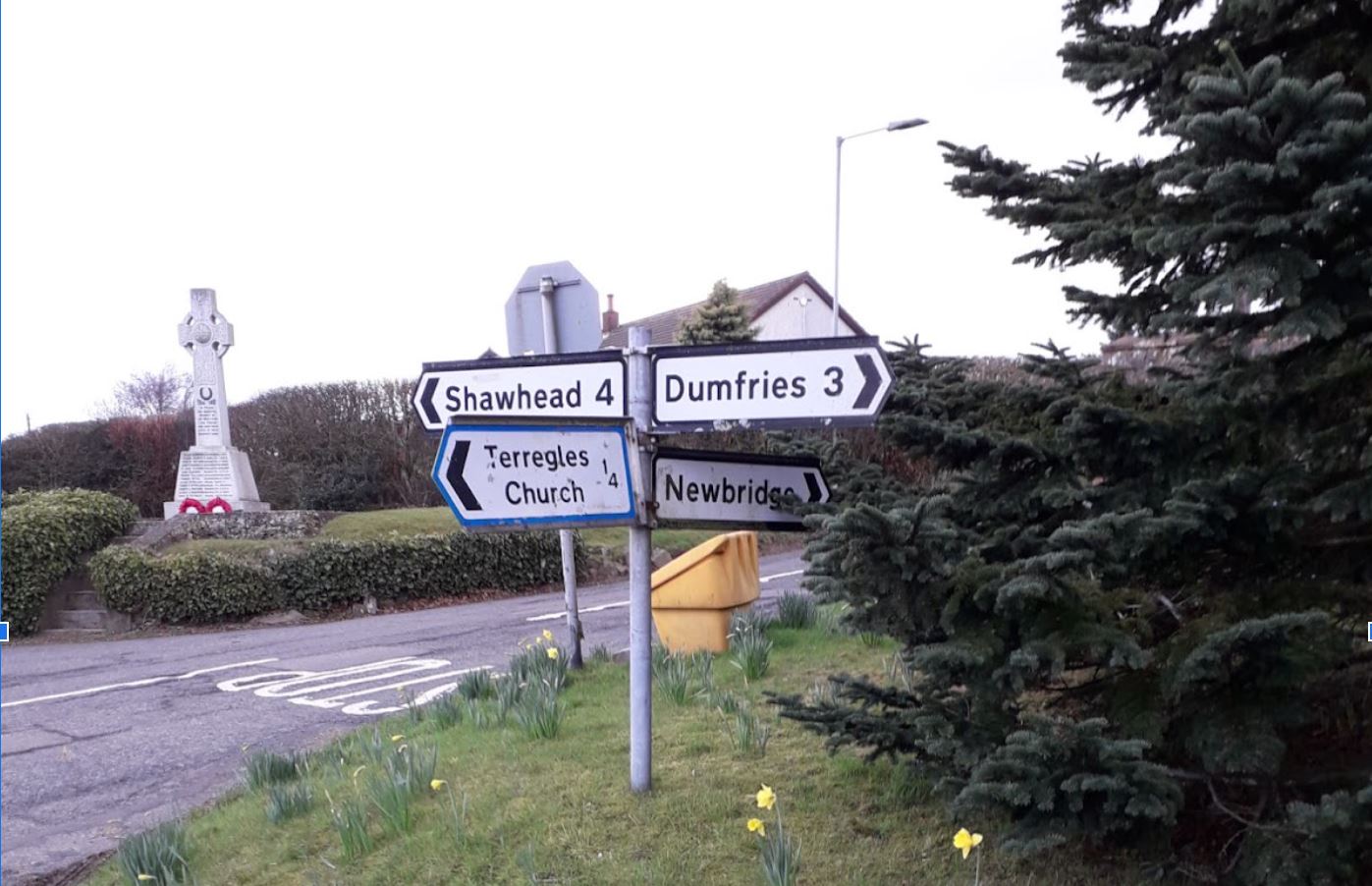 We start with the connection between Terregles and the edge of Dumfries. Then we’ll look at connections off Terregles Road as far as the junction with Hardthorn Road.
Terregles to Dumfries
The road between Terregles and the edge of Dumfries encourages vehicles to travel quickly. It is wide enough for vehicles to pass one another, with a central dashed line in some places which reinforces the idea that there isn’t a need to concede space or slow down when encountering other road users. The road also tends to be busy, particularly at commuting times. Equally importantly, there is no provision for pedestrians to walk the 1.5 miles to the closest part of Dumfries.
Reducing the speed limit here is crucial. Only 1.35 miles of road between the village and Dumfries has a 60mph limit so lowering it would add little to drivers’ journey times but would significantly improve cyclists’ experiences and the perception of road safety.
 While this would make life better for existing cyclists, it will not be enough to encourage more cautious people to cycle on this road. A more ambitious change would be to turn half the existing carriageway into an active travel path, suitable for cycling, walking, wheeling and horse riding. This should be at a different level to the road or have another form of visual and physical separation from traffic. Relying only on visual distinction such as a different colour of surface, is unlikely to be sufficient in changing driver behaviour. This shows people that there is a safe route to ride and walk.
An alternative proposal in the same vein would be an off-road route between Terregles and the Maxwelltown Path, connecting existing footpaths. This would require buy-in from the landowners affected.
While this would make life better for existing cyclists, it will not be enough to encourage more cautious people to cycle on this road. A more ambitious change would be to turn half the existing carriageway into an active travel path, suitable for cycling, walking, wheeling and horse riding. This should be at a different level to the road or have another form of visual and physical separation from traffic. Relying only on visual distinction such as a different colour of surface, is unlikely to be sufficient in changing driver behaviour. This shows people that there is a safe route to ride and walk.
An alternative proposal in the same vein would be an off-road route between Terregles and the Maxwelltown Path, connecting existing footpaths. This would require buy-in from the landowners affected.
Connections within Dumfries
Once on the outskirts of Dumfries how do we links up with the various destinations people might need to reach?
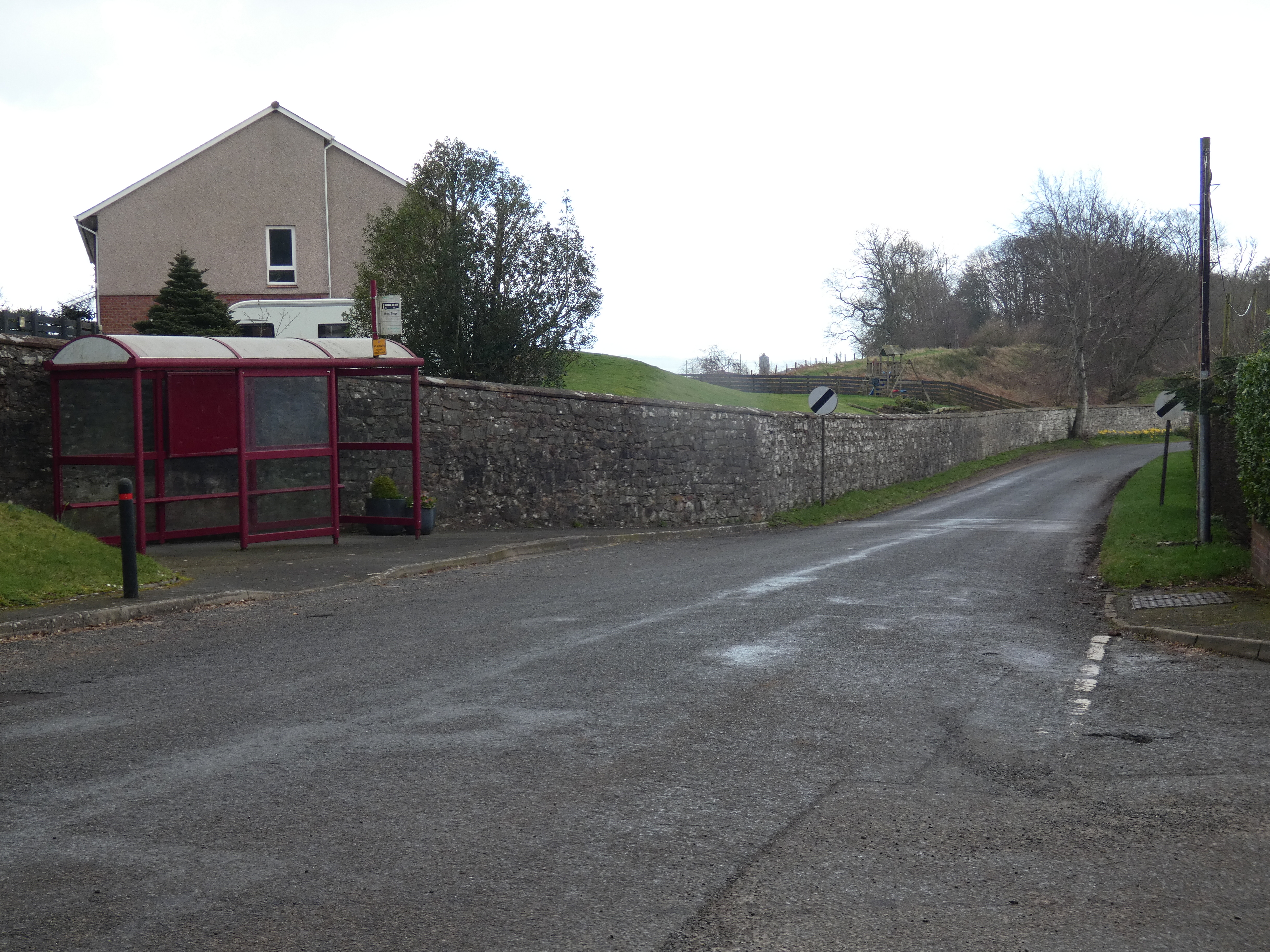
Barnhill
As the map shows, there are two housing areas between Terregles Road and Hardthorn Road, either side of the bypass. Terregles Road also connects with the Maxwelltown Path and the shared use path along Hardthorn Road and up Alloway Road to the North West Community Campus in Lochside.

The first part of Dumfries which Terregles Road reaches is Barnhill. Despite there being a path linking Sandypoint Court to Terregles Road, possibly an emergency vehicle access, this does not offer a clear route for cyclists as there is a gate which is not always open and no dropped kerb. A dropped kerb and an opening beside the gate (or at least just having the gate permanently open) would allow cyclists to get off the busy road sooner and provide a useful link through to Hardthorn Road on to Lochside and the North West Community Campus etc.
Further east along Terregles Road, cyclists could access Hardthorn Road, and therefore Lochside etc., through the residential streets of Barnhill via a path joining Barnhill Road and Caulstran Street. However there is no dropped kerb on the Caulstran Street end and the no entry signs make it unclear whether or not cycling is permitted. It also makes access to the paths very narrow for bikes, cargo and adapted bikes, mobility scooters and pushchairs.

The nearby path connecting Yarrow Drive and Blackley Park Road is a better example and highlights inconsistencies in our infrastructure.
 The housing estates between Terregles Road and Hardthorn Road have excellent potential for pedestrian and cycle permeability and access akin to Summerpark. Making all the connecting paths in these areas suitable for cycling and signing routes to amenities would help achieve this. It would also be helpful to include all the connecting paths, even as they are, on the Dumfries Active Travel Map.
Maxwelltown Path
After passing over the A75 on Terregles Road into town, cyclists have the option to join the Maxwelltown Path which takes them either west towards DGRI or eastwards, towards Cuckoo Bridge, Goldie Park and ultimately the town centre and the railway station. To reach the path, cyclists must first turn right across oncoming traffic to double back onto the path access at the edge of Summerhill. Doubling back is always grating as it’s an additional distance to pedal and worse on foot. Crossing the road at this point is also hazardous as the hump of the bridge over the path reduces visibility. You also have to know it’s there – for some reason this connection is missing from the Dumfries Active Travel Map.
Yet, there is actually another path before crossing the A75 which links Terregles Road to the Maxwelltown Path, avoiding the need to cross the road. This path is from Yarrow Avenue, just 20 metres from its junction with Terregles Road.
 There is also a series of paths in here around Yarrow Drive that connects to Blackley Park Road and Hardthorn Road.
 None of these paths are signed, nor do they appear on the Active Travel Map. These remain routes for people ‘in the know’. Fortunately, Open StreetMap is more up to date and shows all the paths and accesses mentioned here.
Hardthorn Road
Continuing into town along Terregles Road, the road is very wide offering ample room for a segregated cycle track along it. If this were on the south side of the road it could connect directly to the existing link to the Maxwelltown Path (to the left of the picture below).

There is also room for a bypass for cyclists to avoid the Hardthorn Road roundabout, which has poor visibility for traffic coming from the left along Hardthorn Road.

From this point it is only about 170 metres to the 20mph traffic-calmed part of Terregles Road which starts just south of the roundabout junction with Lochfield Road. Extending the 20mph limit to the Hardthorn Road roundabout would make it continuous all the way to Laurieknowe.
