The Details
If you’ve driven in Dumfries, you’ve probably used Brooms Road. It’s a key artery through the town for cars. And if you’ve cycled anywhere in Dumfries, the chances are that you’ve taken a route that avoids Brooms Road. It’s not a pleasant place to ride, especially around Morrisons and Lidl or at the St Michael’s junction. Brooms Road could be as important a route for bikes and pedestrians as it is for cars, if there was safe space to cycle on it.
Brooms Road does have a short section of segregated cycle track, but it’s a bit of an island. To access it from Annan Road you have to cycle along Brooms Road and then cross both carriageways. Once on the cycle track you are deposited by the Morrisons roundabout with no crossing and in conflict with cars exiting from the petrol station. It’s also too narrow and faces the usual issues of sharing space between cyclists and pedestrians.

Glasgow builds segregated routes for cycling along busy main roads. We don’t always have the volume of road space that Glasgow does, but Brooms Road is one of the places where we could finish the job that the short stretch of cycle path started and open up a corner of town that is currently inhospitable to cycling.
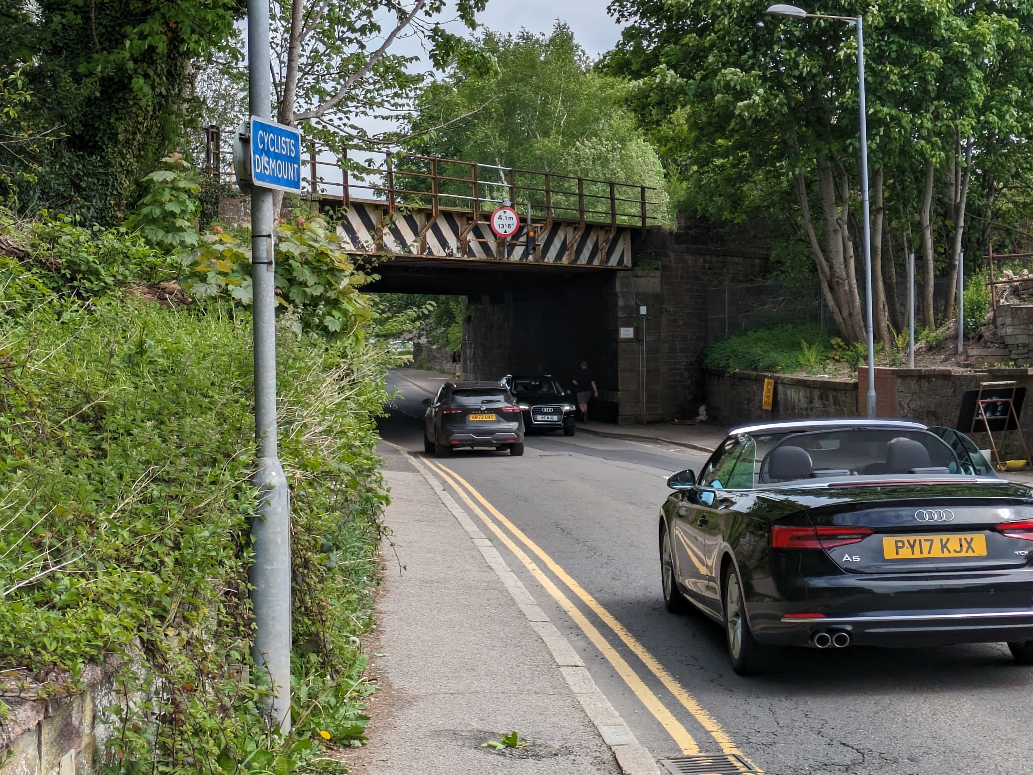
Starting where it comes off Annan Road, Brooms Road is wide. One side is flanked by businesses, so there’s the option to have a cycle track along here, taking space from the roadway if needed, to make room for cyclists and pedestrians. This would then usefully join up with Millburn Avenue, which forms a useful low-traffic alternative to Annan Road and exits onto the Georgetown Road on the edge of Georgetown. The railway bridge over Brooms Road is a pinch point, which might mean a brief section of shared-use path, or else narrowing the carriageway a bit to make space.

The existing stretch of Brooms Road path was built when design standards were different. More space is needed here for pedestrians and cyclists on a two-way path. A kerb or other physical marker is needed between the two so that visually impaired pedestrians can avoid the cycle side of the path. To extend its utility, there needs to be usable crossings onto Eastfield Road and an upgraded crossing at Barrie Avenue (the signed cycle route into Georgetown). At the moment there isn’t even a dropped kerb at the point where the path ends, just a ‘cyclists dismount’ sign. At the other end of the path it’s even worse. Cyclists can either dismount, or take their chances on the Morrisons roundabout with its painted cycle lanes that actively put you into danger by encouraging cyclists to ride around the outside of the roundabout where they could be left hooked by exiting cars (this is no longer in the design guidelines fortunately).
 There’s plenty of space on the other side of the road to bypass the roundabout altogether. A decent crossing here would enable cyclists to get away from the traffic altogether. If heading to Morrisons then it would be better to provide a separate pedestrian/cyclist entrance to the supermarket . As the ‘desire line’ shows, many pedestrians have forged their own way, something that could be easily formalised in conjunction with the supermarket.

Continuing along Brooms Road, there are cycle lanes, but these are actively dangerous, placing cyclists in conflict with cars turning into Lidl. Although we’re not keen on cycle tracks that switch back and forth between the sides of the road, one swap here would be okay, and there’s plenty of room to give everyone – pedestrians, cyclists, and drivers – their own space here for most of the length of the road.
Once past Lidl, there are houses on both sides and not enough space to make a decent cycle track until you get to the Brooms Road Car Park. From there on, however, the road is wide and increasingly hostile for both cyclists and pedestrians, with another on-road cycle lane putting cyclists into conflict with turning traffic.

As Brooms Road turns into St Michael’s Bridge there’s masses of space not just to put in a cycle track but even to have Dumfries’s first CYCLOPS (cycle optimised protected signal) junction as per Cycling By Design guidelines. This would help with access to schools like St Joseph’s and St Michael’s, by connecting them to the main traffic free route along the Whitesands and via Dock Park.
