The Details
The junctions of Glasgow Street, Terregles Street and Galloway Street form a significant barrier to people walking or cycling on the Maxwelltown side of the river.
Galloway Street / Buccleuch Street Bridge / Laurieknowe (or Galloway St from now on for ease of reference!) is very busy and intimidating to cycle along or across. It’s a very active barrier to active travel where vehicle movements are prioritised over pedestrians and cyclists. The pedestrian crossings are “walk with traffic” crossings of Galloway Street and Glasgow Street. No crossings are provided on the Buccleuch Street Bridge arm of the junction — indeed pedestrians are blocked from crossing at all by a lengthy set of railings. There are advanced stop lines for cycles on all three arms of the junction with Glasgow St, but there are only advisory lanes to get to them on the Galloway Street and Buccleuch Street Bridge arms.
This junction effectively divides the Maxwelltown side of the river into two, north of and south of Galloway Street. To the north, a shared cycle and pedestrian path on College Street links to other cycle infrastructure, including the Maxwelltown Path and routes to Lincluden, Barnhill and Lochside. There is also a connection to the Loreburn Bridge, and thence to the Academy and Loreburn Primary, the town centre and the east side of the river. However, it is blocked by the pedestrian railings at the Galloway Street end.
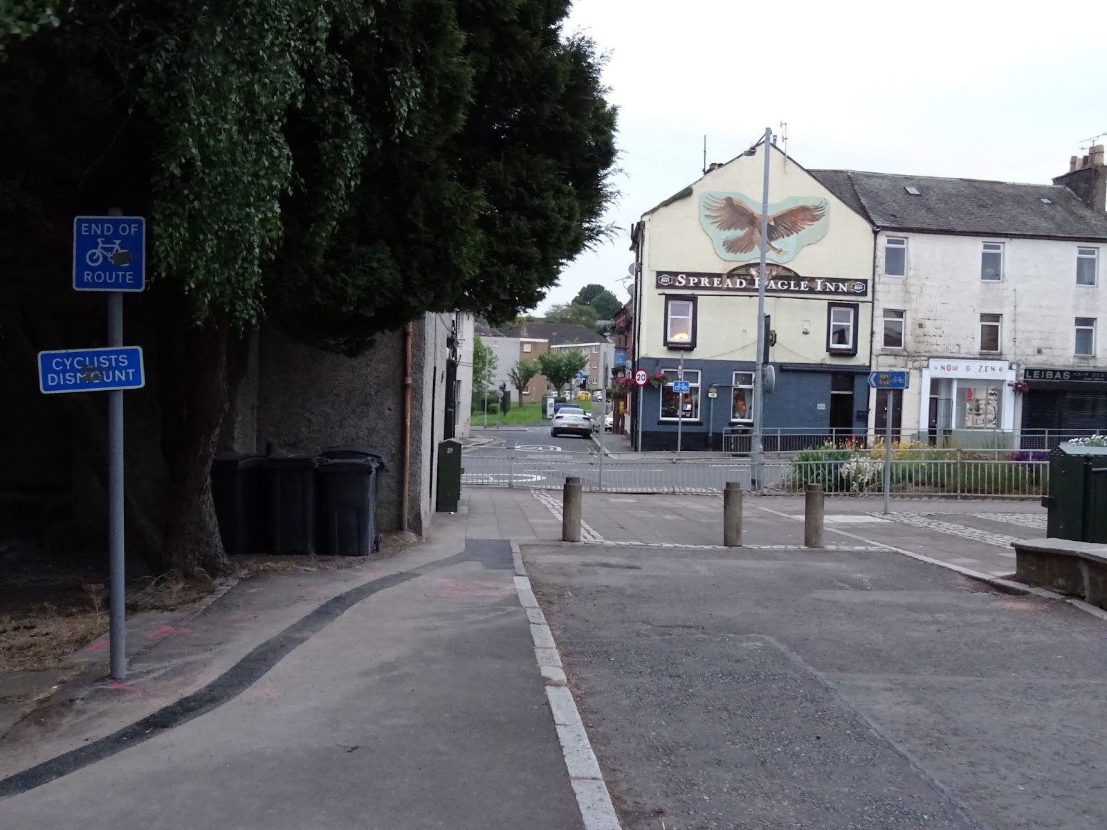
South of Galloway Street are lightly trafficked 20mph roads that connect to the path through Mill Green and down the west side of the River Nith to the Kirkpatrick Macmillan Bridge and onwards to Mountainhall, the Crichton and settlements in the south.
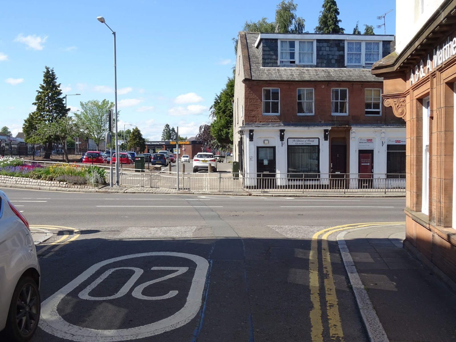
There is clear potential for a good cycle route from the north side of Dumfries to the south side, all the way down the west side of the River Nith, except for this short gap – but without a convenient way to cross from the cycle path to the quiet streets beyond, it might as well be miles.
Currently, cyclists must dismount – something which is not always possible for those riding adaptive cycles such as trikes – at the end of the shared-use path on College Street, walk to the staggered crossing on Glasgow Street then to the staggered crossing on Galloway Street then along the pavement to remount once on Market Square (see the map). This, incredibly, takes anywhere between four and six and a half minutes!
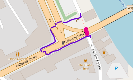 A toucan crossing between the end of College Road over to the entrance into Market Square offers the best solution. This would provide a route suitable for use by cyclists, save a lot of time making it much more appealing to cycle and walk this way. It would also provide a crossing that is accessible for users of trikes and other adaptive cycles and mobility scooters, as well as a much nicer and more convenient way for pedestrians to cross, which could lead to more footfall at the nearby shops. The current sequence of the traffic lights even has a phase when no or little traffic is moving in that section of road so it need not cause extra congestion by delaying traffic.
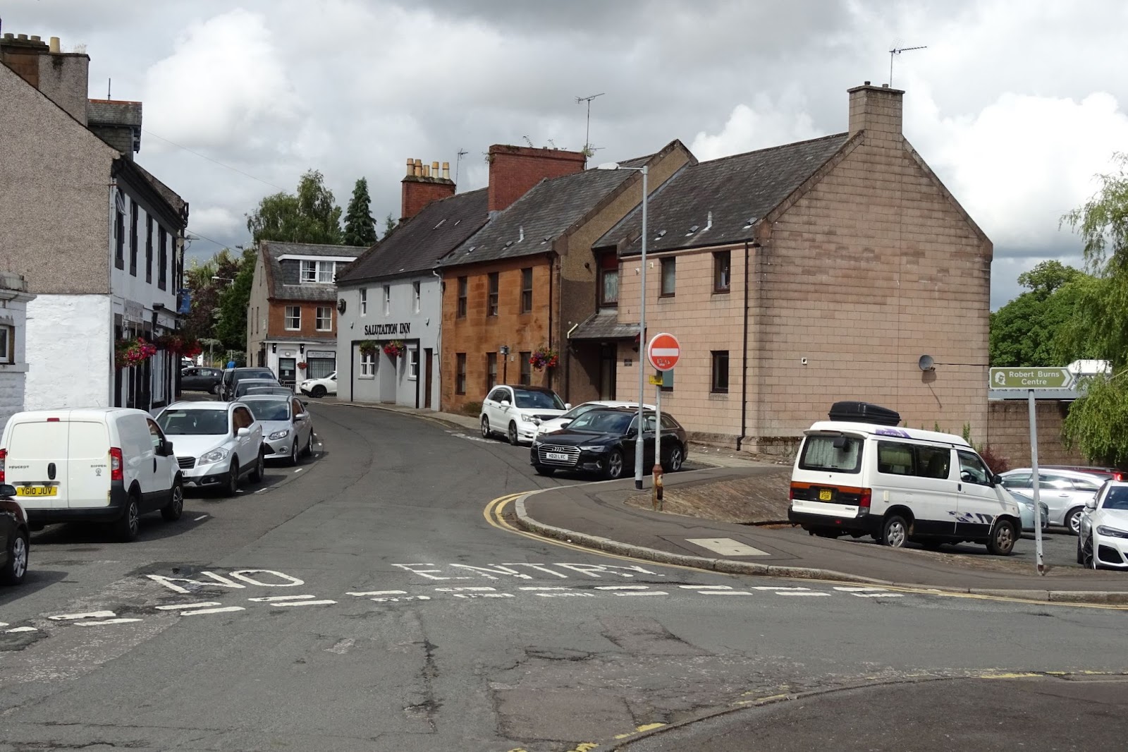 When heading north, there is a second obstacle in that the two roads connecting Mill Road to Galloway Street, Market Square and Howgate Street, are both one-way north to south so you cannot legally cycle from Mill Road to Galloway Street. This makes it even more time consuming to head northwards – the shortest route being up Maxwell St – one of the steepest hills in Dumfries – and then back down along the main road, or dismounting and wheeling your bike. The alternatives involve crossing the river twice, including carrying your bike down the steps on Devorgilla Bridge. In the worst case, a rider who is unable to dismount or get their bike down the steps, and feels unsafe on busy roads, would need to cycle all the way down Mill Green to the Kirkpatrick McMillan Bridge, then all the way up Whitesands to the Loreburn Bridge to return to the west side of the river – a diversion of almost 3 miles.
This could be easily solved by allowing contraflow cycling in Market Square, either through signs permitting it or removing a few parking spaces to put a contraflow cycle lane in. Alternatively, making Market Square a cul-de-sac for cars but permeable to bikes would keep it as a quiet street but enable it to be used as a cycle route in both directions, not just one.
Creating a continuous cycle route on the west side of the river would then offer an alternative route when the Whitesands is occupied by fairs, is flooded or when construction of the flood protection works goes ahead. It also allows cyclists to avoid the shared-use path along the Whitesands which can get very busy with pedestrians, reducing cyclist-pedestrian conflict.
Further west along Galloway St/Laurieknowe, there is another busy junction at the end of Terregles Street. Terregles Street is the direct route from Summerhill and communities west of Dumfries (see the Terregles chapter) to the town centre. It has a 20mph speed limit, making it potentially more attractive to cyclists as a route, albeit made more difficult to cycle on due to speed cushions. Terregles Street is also home of the DG2 Wheels bike shop, so a key destination for cyclists.
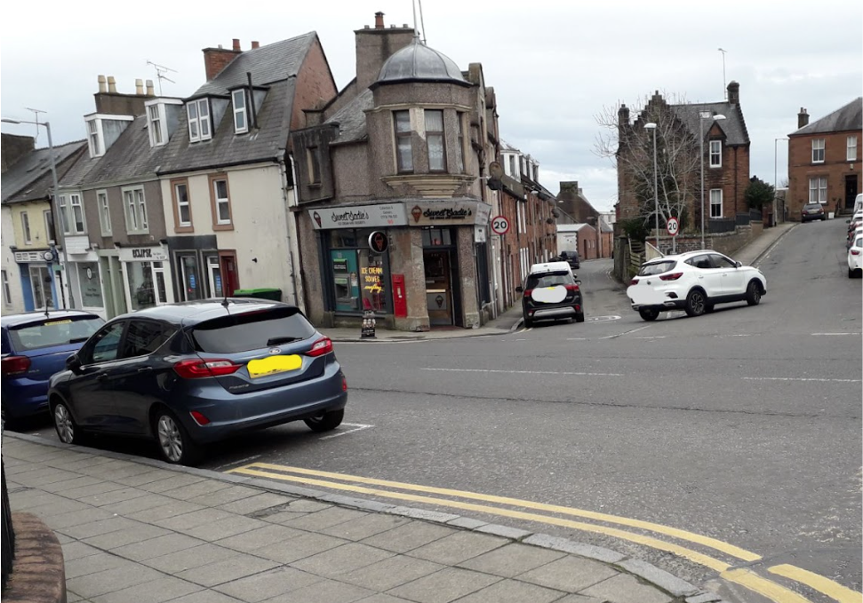
For cyclists heading into town, there is the option of crossing straight into Howgate Street to avoid cycling along the busier roads. If a useful solution was implemented at the end of Buccleuch Bridge, as described above, and there were safe attractive crossing points along Glasgow St, then cyclists would tend to use that. However, as it stands, crossing to Howgate Street is currently the least worst option when coming in from the west for cyclists heading for this side of the river. It is also the obvious route for cyclists heading towards New Abbey Road.
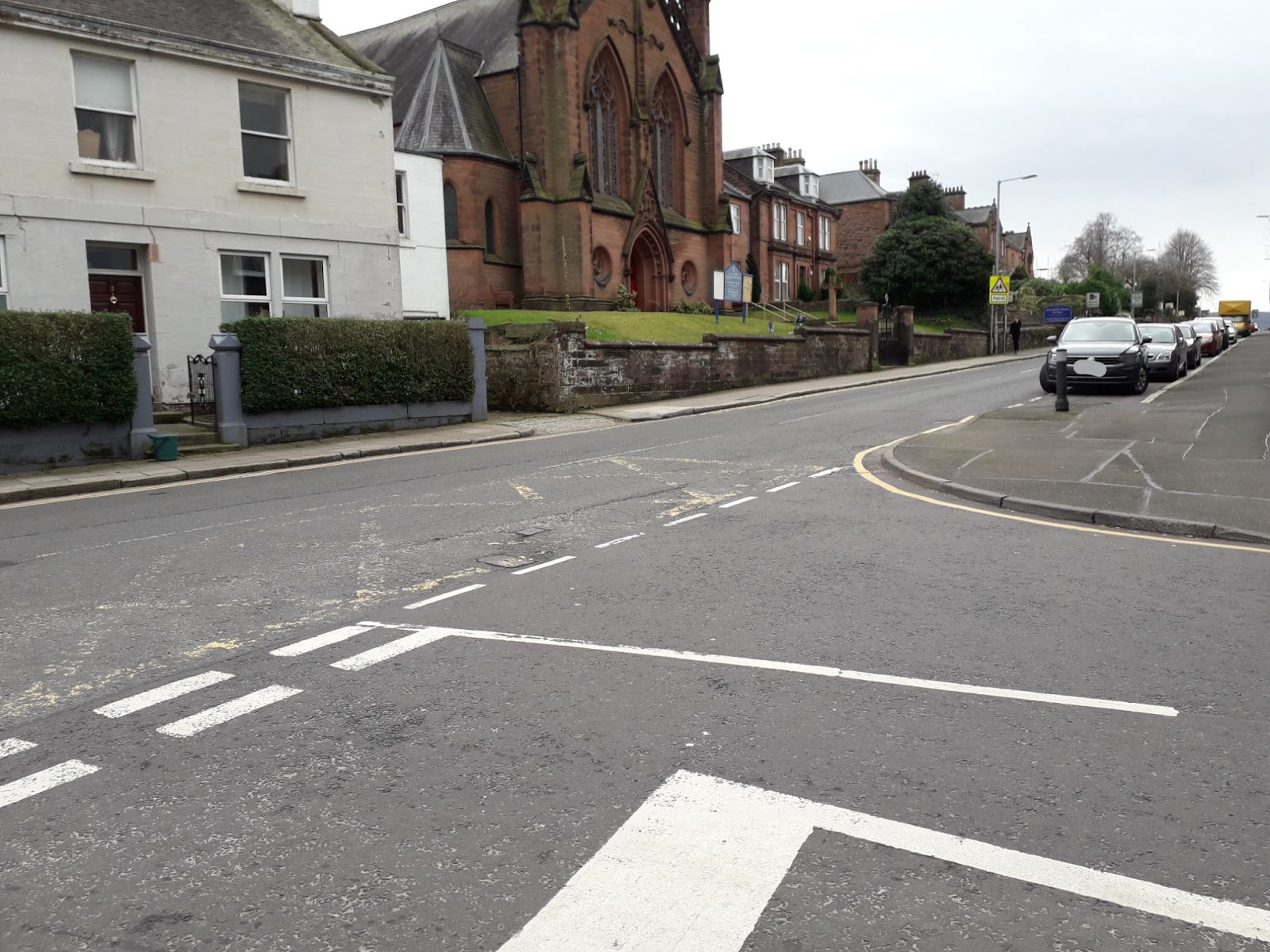
Where Terregles Street meets Laurieknowe, there is nothing to make a cyclist feel safe. This junction is tricky for any road user, but particularly for a vulnerable cyclist. Parked cars limit visibility, meaning it can be necessary to edge into the main road to get a clear view. Queueing traffic, which also limits visibility, a bus stop, and the traffic coming round the corner from Glasgow Street all need to be contended with. Traffic signals on the main junction with Terregles St, if this were possible, would make it easier for pedestrians and cyclists to use, and potentially safer for all road users. As with Market Street, making Howgate Street two-way for cyclists would allow cyclists to reach Terregles Street northbound without having to divert or dismount.

